Showcase: The Sword Coast in 3D — Experiments with Toril GIS
It is always a pleasure to see dry geographic data come to life in the hands of talented researchers. Today, I want to share a project by Alena Maltseva, who used the Toril GIS Sample to create an interactive 3D model of the Sword Coast.
What’s happening here?
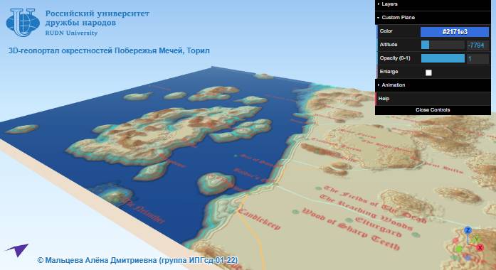
The project is an animated 3D map of the most famous region in the Forgotten Realms. The model is built upon our Digital Elevation Model (DEM), supplemented with key points of interest ranging from Luskan to Baldur’s Gate.
Tech in brief: What is QGIS?
If this is your first time on our site, acronyms like “GIS” might sound intimidating. In reality, it’s quite simple:
- GIS (Geographic Information System) is a “smart map.” Unlike a regular drawing, every city or forest in a GIS is a database object that “knows” its exact coordinates, area, and history.
- QGIS is like “Photoshop,” but for maps. It is our project’s primary tool, where we assemble the geography of Toril piece by piece using vectors and terrain data.
- qgis2threejs is a wizard of a plugin. It takes flat data from QGIS and, utilizing our elevation model, transforms it into the interactive 3D world you see in Alena’s project.
Why does it matter?
This project is a perfect example of why we develop Toril GIS. We are building the foundation (precise borders, elevations, roads) upon which lore researchers and developers can create their own unique visualizations.
Keep experimenting, creating, and sharing your maps!
Usage Terms: This page includes unofficial Fan Content permitted under the Wizards of the Coast’s Fan Content Policy. Not approved/endorsed by Wizards. Portions of the materials used are property of Wizards of the Coast. © Wizards of the Coast LLC.