Under the Hood of Toril GIS: How the World of Faerûn Is Built
The Toril GIS project keeps growing and evolving. Over the past few months, we’ve laid a solid foundation for everything to come: a centralized database is up and running, key technical decisions have been made, and the digitization of maps is well underway.
What’s happening right now
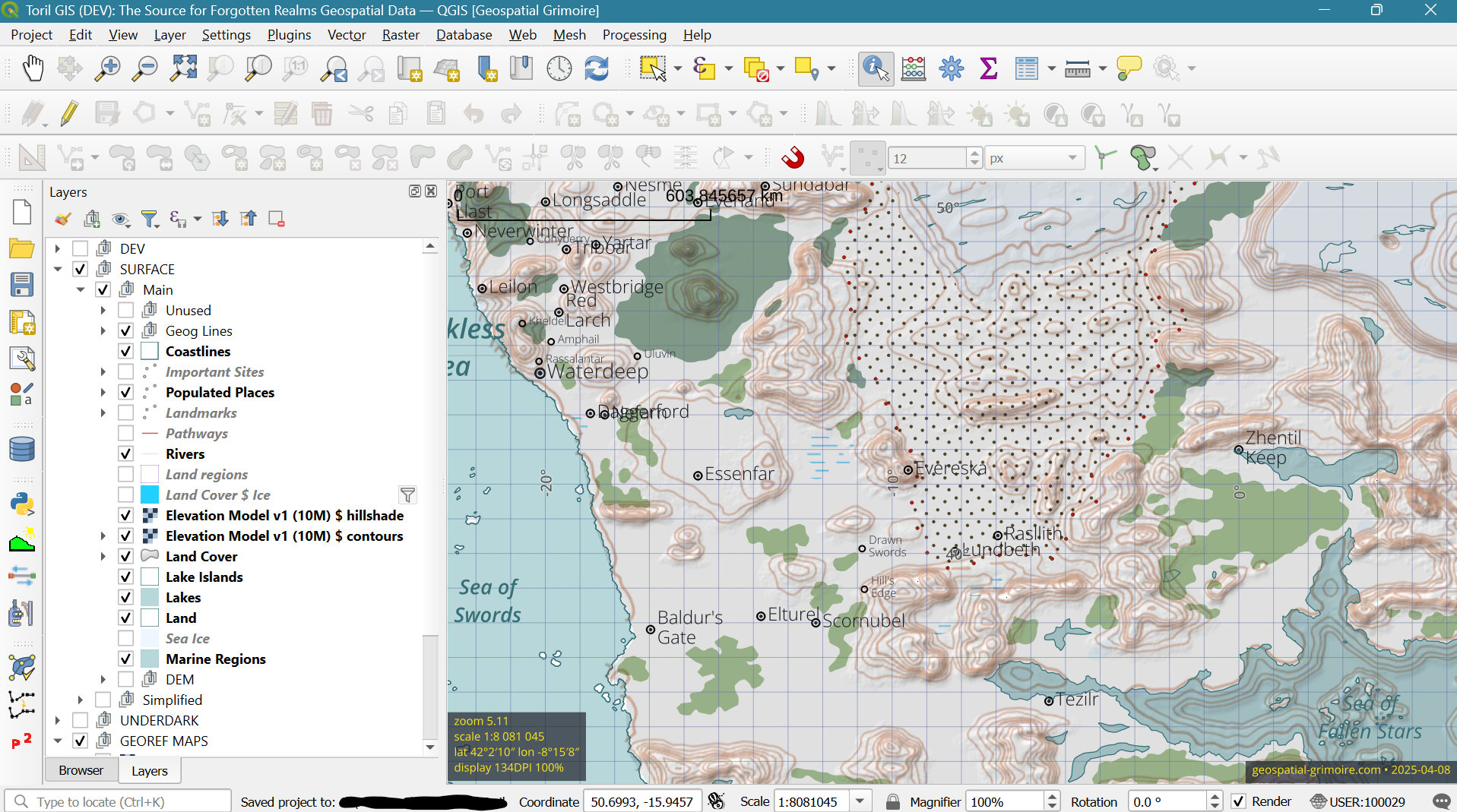
Toril GIS is envisioned as an open geospatial database for the world of Faerûn — made for game masters, cartographers, writers, and fans of the Forgotten Realms. The project is based on cartographic data from the Forgotten Realms Interactive Atlas. Right now, we’re in an active development phase:
- The centralized database is up and running, with all key schemas and tables in place.
- Forgotten Realms maps are being digitized, with a focus on major features, like cities, rivers, points of interest, and roads.
- The QGIS project is taking shape, with custom styling and editing forms.
- Global and regional layers are supported, along with the first attempts to map the Underdark.
Technical insights: behind the scenes
Here’s a look under the hood for those curious about how Toril GIS is built.
The database: heart of the system
The Toril GIS database is organized into thematic schemas, each with its own purpose:
-
core: holds the main geographic features — settlements, roads, rivers, landforms, and boundaries. -
aux: contains simplified versions, derived layers, and map annotations. -
meta: stores configuration data, styles for QGIS, and other metadata. -
temp: serves as a workspace for in-progress or temporary layers.
All spatial data is stored using the geography data type, aligned with our custom Toril GCS — a coordinate system crafted specifically for the Forgotten Realms.
What kind of data lives inside?
Toril GIS isn’t just a place for points and polygons — it’s a structured archive of the world’s geography and lore. Here’s what the database captures:
- Natural features — rivers, lakes, mountains, coastlines, and other terrain elements.
- Civilized features — cities, villages, roads, ruins, landmarks.
- Conceptual elements — political boundaries, regions of influence, and map graticules.
- Underdark layers — underground settlements, tunnels, and regions beneath the surface.
- Supporting information — map sources, multilingual names and descriptions, visibility flags, and timeframes.
Each record is enriched with metadata for visualization, labeling, source tracking, and review — designed to support a growing multilingual dataset.
Coordinate systems, tailored for Toril
Several coordinate systems are used in the project:
- Toril GCS — a geographic CRS centered on the FRIA meridian, used for storing GIS data.
- Toril PCS (Patterson) — a projected CRS for use in QGIS.
- Toril GCS (Myth Drannor) — an alternate geographic CRS for displaying coordinates relative to the Myth Drannor meridian.
What’s next?
Coming up:
- Continue digitizing key maps from the Forgotten Realms Interactive Atlas and prepare the first release of Toril GIS.
- Add mechanisms for syncing translations and metadata.
- Develop the first visualizations and publish a prototype of the Toril Explorer — a web map powered by the database.
For now, the easiest way to support Toril GIS is simply to stay close. Check the Geospatial Grimoire blog once a month to discover new layers, maps, and behind-the-scenes magic — together we’ll give shape to the world of Faerûn!