Crafting Coordinate Systems for Faerûn and Beyond
Developing and selecting coordinate systems for Toril GIS comes with unique challenges in mapping fantasy worlds. This process highlights the importance of precision and customization to ensure accurate integration of diverse geospatial data.
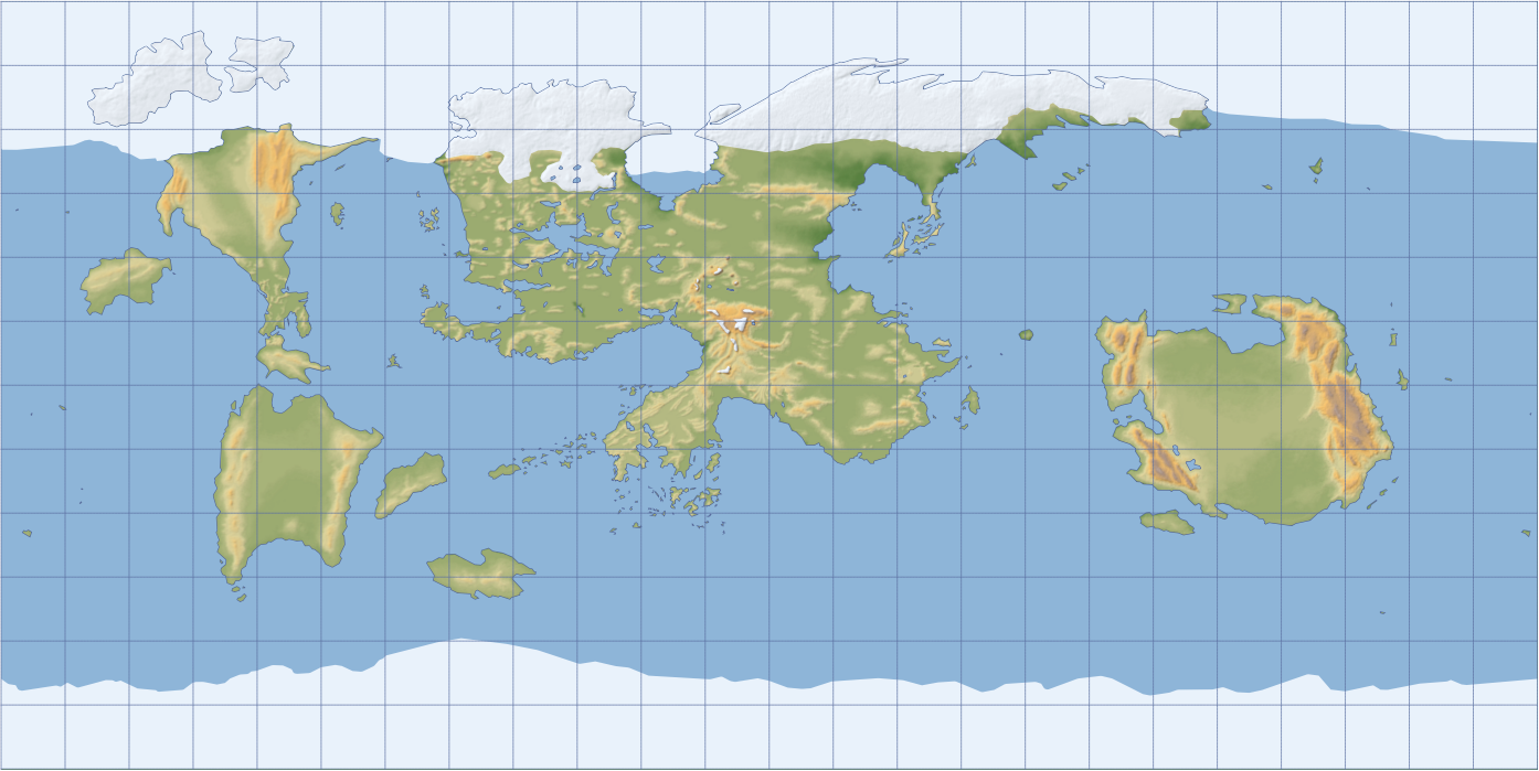
The Forgotten Realms (abbreviated FR, or Forgotten Realms) is a popular setting for Dungeons & Dragons (D&D), taking place on the fictional planet Toril. To start creating maps for Toril, we must decide on a coordinate reference system (CRS). If you examine officially published FR maps and atlases, such as the Forgotten Realms Atlas (1990) and the Forgotten Realms Interactive Atlas (1999), you won’t find specific CRS references. However, upon closer inspection, one can reasonably infer that most maps were created using the Plate Carrée projection, where the grid of parallels and meridians forms perfect squares from east to west and pole to pole. This approach is simple and convenient because geographic coordinates can be directly applied to the map.
Geographic Coordinate System
A Geographic Coordinate System (GCS) is based on a sphere or ellipsoid, with locations defined by angular measurements expressed in degrees, which are then displayed on a flat surface using the Plate Carrée projection. The dimensions of Toril’s ellipsoid are already known: it has an equatorial axis \(a\) of 6410 km (3983 miles) and a polar axis \(b\) of 6370 km (3958 miles). In GIS terms, the GCS definition for Toril in WKT-CRS format would look like this:
GEOGCRS["Toril GCS",
    DATUM["Toril",
        ELLIPSOID["Toril",6410000,160.25,
            LENGTHUNIT["metre",1]]],
    PRIMEM["FRIA",0,
        ANGLEUNIT["degree",0.0174532925199433]],
    CS[ellipsoidal,2],
        AXIS["latitude (Lat)",north,
            ORDER[1],
            ANGLEUNIT["degree",0.0174532925199433]],
        AXIS["longitude (Lon)",east,
            ORDER[2],
            ANGLEUNIT["degree",0.0174532925199433]],
    USAGE[
        SCOPE["Web mapping and visualisation of Toril."],
        AREA["World."],
        BBOX[-90,-180,90,180]]]
This code can be used in the custom CRS dialog in QGIS. Note that for defining the ellipsoid in WKT-CRS, the inverse flattening of Toril’s ellipsoid is used instead of the polar axis \(b\). This value is calculated as \(\frac{1}{f} = \frac{a}{(a-b)}\) and equals 160.25.
If we georeference existing FR maps in QGIS using this GCS, we’ll find that the Prime Meridian (abbreviated PM, passing through the center of the image) runs near the city of Chophon in the mountainous region of Tabot in central Kara-Tur. This wasn’t a deliberate choice like the Greenwich Meridian on Earth—it simply happened to align this way. To avoid ambiguity, I named this arbitrary meridian FRIA PM (after the source material: Forgotten Realms Interactive Atlas) to distinguish it from another proposed Prime Meridian, MD PM (named after the ancient city Myth Drannor). The Myth Drannor meridian was mentioned by Ed Greenwood, the creator of the FR setting, as a possible equivalent to Earth’s Greenwich. However, in a GCS with MD PM, the 180° meridian bisects the eastern continent of Osse.
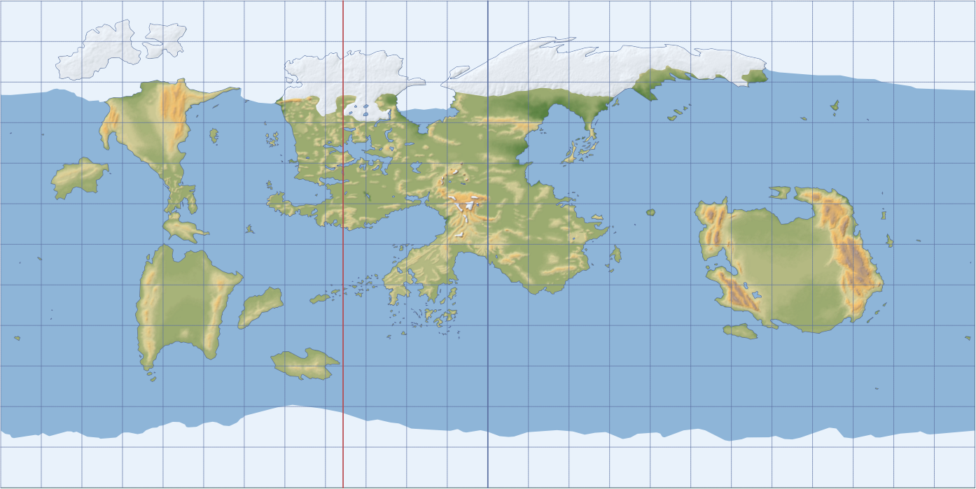 Toril map in GCS (Plate Carrée projection) centered on the FRIA meridian (blue line), as in the source material. The red line shows the MD meridian according to FR lore.
I would prefer to use MD PM as a base to align with the lore, but this would greatly complicate the process, as all source maps would need to be modified before georeferencing in GIS. The eastern part of the image would have to be cropped and moved to the left. Ultimately, I decided on the following approach: for simplicity, all data in Toril GIS will be georeferenced relative to the FRIA PM in any GCS. However, when it is necessary to measure coordinates relative to MD PM, only longitude needs to be recalculated:
\[\lambda_{\text{MD}} = \lambda_{\text{FRIA}} + 53.48°\] \[\lambda_{\text{MD}} = \begin{cases} \lambda_{\text{MD}} — 360° & \text{if } \lambda_{\text{MD}} > 180° \\ \lambda_{\text{MD}} + 360° & \text{if } \lambda_{\text{MD}} < -180° \\ \lambda_{\text{MD}} & \text{otherwise} \end{cases}\]Here are the coordinates of some locations in the Toril GCS relative to both the FRIA and MD Prime Meridians:
| Location | Continent | Latitude (FRIA and MD) | Longitude FRIA | Longitude MD |
|---|---|---|---|---|
| Myth Drannor | Faerûn | +41.41° | -53.48° | 0° |
| Waterdeep | Faerûn | +45.20° | -73.63° | -20.15° |
| Konigheim | Between Faerûn and Kara-Tur | +9.89° | -14.90° | +38.58° |
| Tukan | Maztica | +15.23° | -115.98° | -62.5° |
As you can see, coordinates are relative.
Projected Coordinate Systems
I have not yet seen the Forgotten Realms in coordinate systems other than GCS. While GCS is a good starting point, for better visualization, we need to experiment with Projected Coordinate Systems (PCS), which are based on GCS and map projections. A map projection involves mathematical computations to convert angular coordinates into Cartesian coordinates on a flat surface. Below are some PCS options I found suitable for Toril GIS.
Mollweide Projection
An equal-area pseudocylindrical projection.
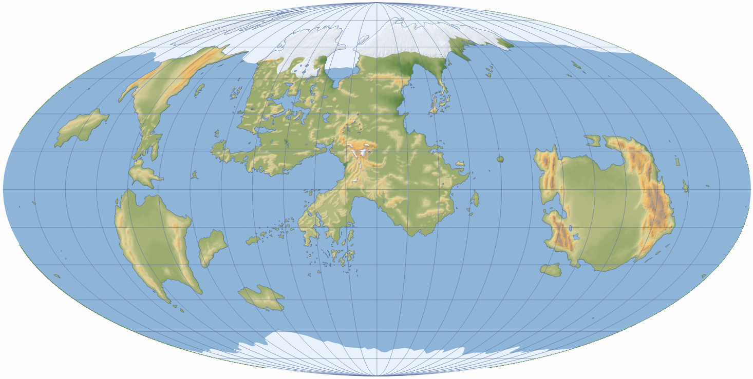 Toril map in Mollweide projection centered on the FRIA meridian.
Behrmann Projection
A cylindrical equal-area projection. It heavily compresses polar regions. But there’s nothing in them anyway, right?
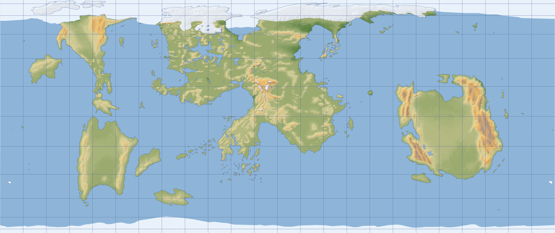 Toril map in Behrmann projection centered on the FRIA meridian.
Orthographic Projection
This projection shows Toril’s hemisphere as seen from space, greatly distorting areas near the edges. It provides the best view of an entire hemisphere.
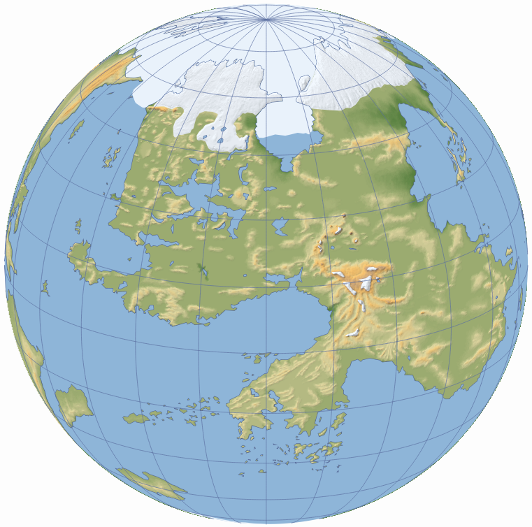 Toril map in an orthographic projection centered on Faerûn.
Mercator Projection
In fact, this projection is useless for Toril GIS, and I will not use it since it greatly distorts polar regions. I included it here to give you a broader idea of projections.
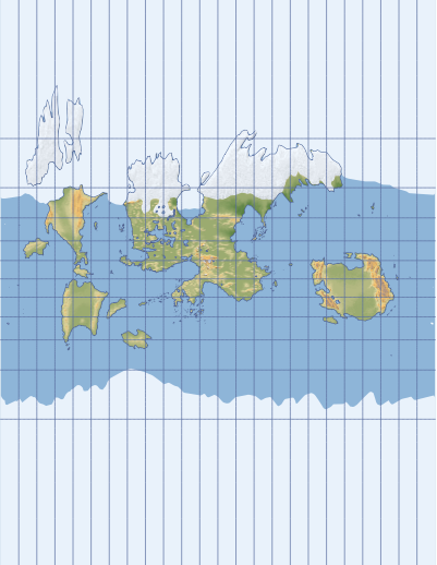 Toril map in Mercator projection centered on the FRIA meridian.
WKT-CRS files for all mentioned systems can be downloaded from the Toril GIS repository.
